by Gloria Nobile
Will Sos Enattos be the home of the future gravitational wave observatory, the Einstein Telescope (ET)?
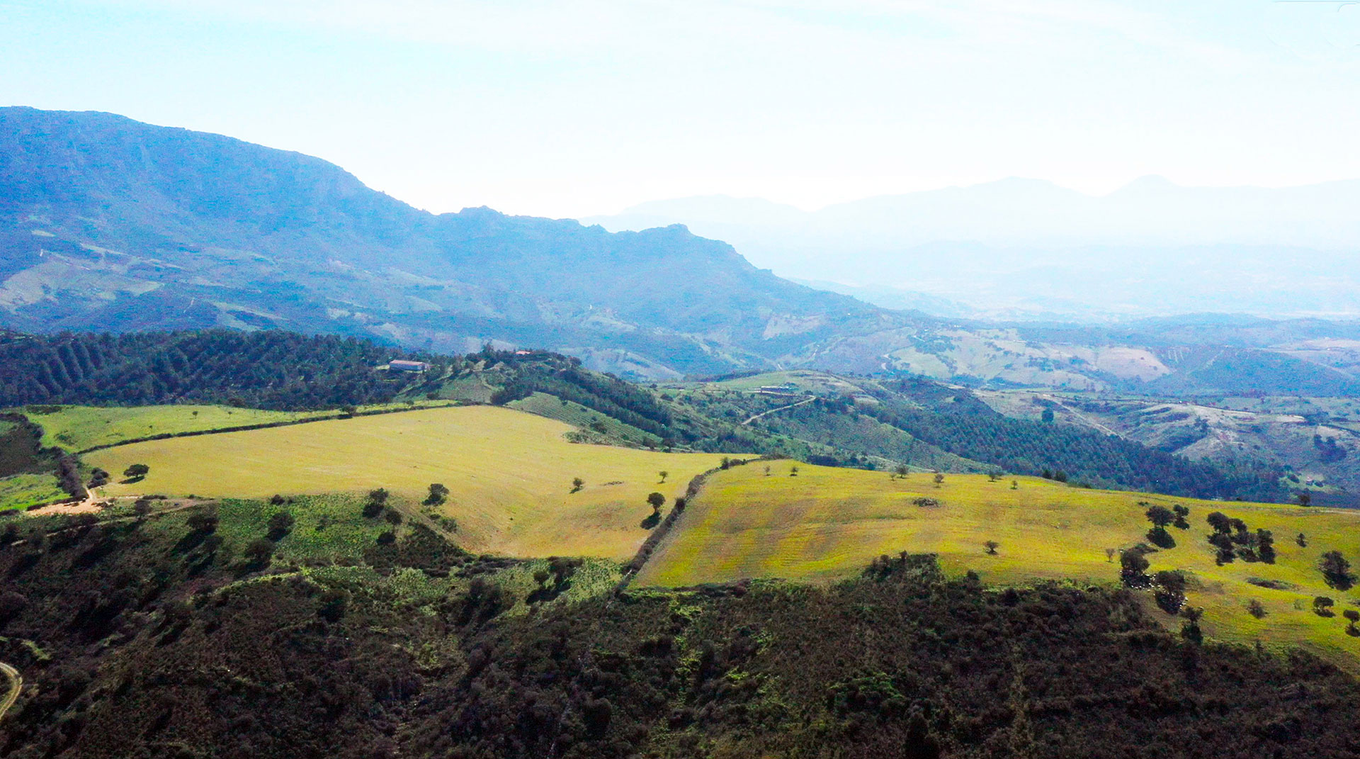
The ET project involves the construction of a large underground infrastructure consisting of three caverns housing laboratories, connected by two or three tunnels each about 11–15 kilometers long. Overall, the interferometer will be located at a depth of approximately 100 to 500 meters within the mountains of Sardinia, between the municipalities of Bitti and Lula, in the Nuoro region. Building the interferometer in this area — one of the most tectonically stable in Italy — and at these depths is intended to allow it to operate in conditions of “silence,” isolating it from vibrations caused by seismic waves and human activities. These vibrations are considered “noise,” a source of interference for the measurements ET will have to make. Water flowing through fractures can also represent a source of noise and, in addition to being a resource that needs to be managed, may pose potential issues for the construction, maintenance, and operation of the observatory. For this reason, efforts are being made to identify areas for the ET vertices that are as far as possible from the presence of underground water.
To discover where and how much water flows and tends to accumulate, the area north of Sos Enattos has been explored using various techniques. In 2020–2021, the first two wells (about 250 meters deep) were drilled, providing initial information about the rocks and water circulation in the area. Over the years, various geomorphological observations have been made through satellite imagery, studies of outcropping rocks based on structural geology, and geophysical measurements of the underground structure using vibrating masses and geophones (active seismic techniques), as well as geoelectrical surveys involving the passage of electricity through the ground. This transdisciplinary research, coordinated by researchers from the University of Sassari, involved the National Institute for Nuclear Physics (INFN) and the National Institute for Geophysics and Volcanology (INGV), and was recently summarized in a new article published in Tectonophysics.
«Many people with different areas of expertise are working to demonstrate the qualities of Sos Enattos and the surrounding area that will host ET underground. In this article, we combined different techniques to measure the size of the rock volumes where water circulates, and the shape and distribution of these fractured zones, which we call aquifers», explains Luca Cardello, a structural geology researcher at the University of Sassari. «For the first time, we characterized in great detail the aquifers in the area’s metamorphic rocks, the schists, and in the magmatic rocks, the granites. In both cases, we found high-quality rocks with very little water. When water was present, it was concentrated in fractured volumes. We demonstrated that we can predict the presence of these aquifers — known in the literature as ‘perched aquifers’ — from satellite image analysis and field studies of these structures. Geophysics then allowed us to understand how they continue in depth. Finally, the wells allowed us to intercept these aquifers, confirming our hypotheses».
Thanks to data obtained from sensors placed 250 meters deep at the bottom of the wells, noise was measured not only on the surface but also underground.
«It wasn’t easy, because the background noise is so low that there was a risk of measuring the noise produced by the instruments themselves», notes Domenico D’Urso, professor at the University of Sassari and scientific coordinator of ET Italy.
This investigation phase is part of the pre-feasibility study. Supporting it are ongoing geological and geophysical analyses of 12 new deep boreholes, reaching depths of up to 500 meters. Later, as part of the executive project phase, new measurement campaigns will be conducted along ET’s planned routes, to better predict the distribution and quality of the rocks at depth, ensuring the device performs optimally and remains as isolated as possible from all sources of seismic noise.
«This publication marks a first step toward developing geological research in the area, which, along with studies by the University of Cagliari, the Servizio Geologico and the INGV will allow for an increasingly comprehensive understanding of a much larger region, thereby exploring its potential in terms of risks and resources», adds Cardello.
«From a hydrogeological standpoint, water presence turned out to be only superficial; we did not find significant deep aquifers that could interfere with the construction of the underground caverns», concludes D’Urso. «All of this confirms the suitability of the site in terms of geological quality, and thus its capacity to host the infrastructure without major expected problems».