Starting today, Friday, May 15, a helicopter will fly at low altitude over the Sardinian candidate area to host the future Einstein Telescope (ET) gravitational wave observatory. The activities will mainly involve the territories of the municipalities of Onanì, Lula, Bitti, and Orune, in the province of Nuoro, as well as parts of the municipalities of Nule, Buddusò, Lodè, Alà dei Sardi, Osidda, and Benetutti (located within the provinces of Nuoro, Sassari, and Gallura North-East Sardinia).
The flights, promoted and organized by the National Institute for Geophysics and Volcanology (INGV) in collaboration with the University of Cagliari, will carry out a geophysical survey to gather information about the subsurface down to a depth of 500 meters, improving knowledge of the geological and hydrogeological structure of the area proposed for ET while ensuring respect for the territory.
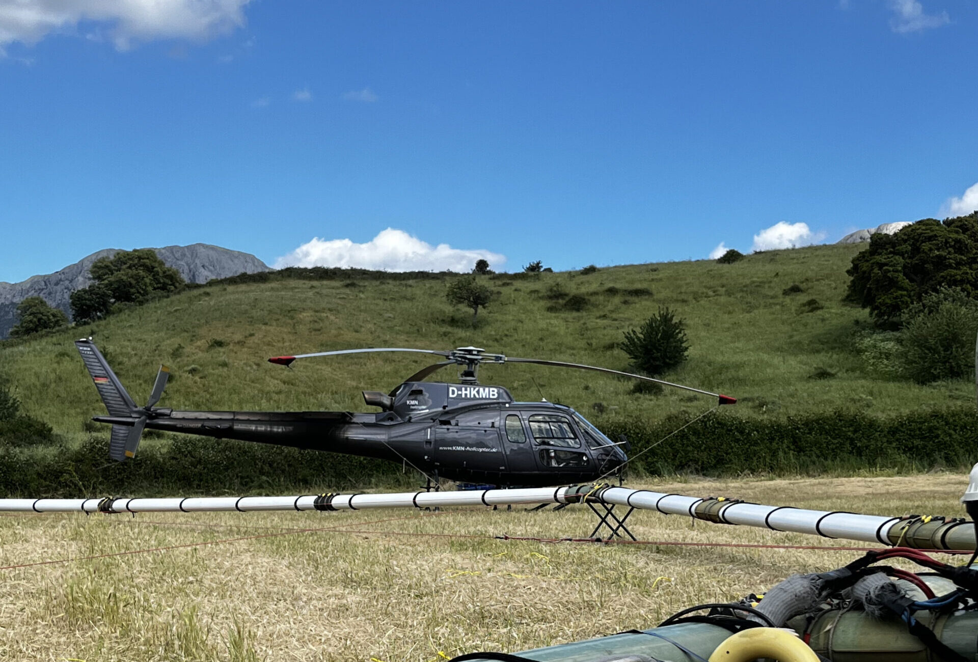
The helicopter, equipped with a hexagon-shaped antenna, will fly at an altitude of about 50 meters, conducting daily flights for approximately one month (weather permitting), traveling 2,800 kilometers and covering an area of around 400 square kilometers. The collected data will then be processed to build a 3D geological model. The survey method being used, known as AEM (Airborne Electromagnetics), is already well established and regularly used worldwide. In Italy, it has previously been adopted in Sulcis, the Venetian Lagoon, the province of Brescia, and Sicily.
«This survey represents a fundamental step in the scientific characterization process of the area proposed to host the Einstein Telescope, one of the most important European research infrastructures of the near future», said Fabio Florindo, president of INGV. «The activity will allow us to acquire valuable data to deepen our understanding of the subsurface using safe and non-invasive methodologies, with full respect for the environment and local communities. The collaboration with the University of Cagliari also confirms the value of synergy among research institutions involved in a project of great scientific and strategic importance for Sardinia and for Italy. I would also like to thank the Municipality of Lula and the local administrations for the cooperation and support they have shown in facilitating the research activities».
The survey poses no risk to public health, since the electromagnetic waves emitted by the antenna are of low intensity. Furthermore, the helicopter will not fly over buildings, urbanized areas, or infrastructure, and no video or photographic recordings will be made, ensuring citizens’ privacy. The only inconvenience for residents will be the noise of the helicopter rotor during flights over rural areas, which could frighten horses and other animals.
The experiment is part of the research activities of the Geophysical Characterization Center for Einstein Telescope (CCGET), recently established by INGV to coordinate activities in Sardinia. Further information about the helicopter-based geophysical survey and the Center’s other activities is available on its website, which will publish updates to the helicopter flight plans with two days’ notice.